The Elder Scrolls
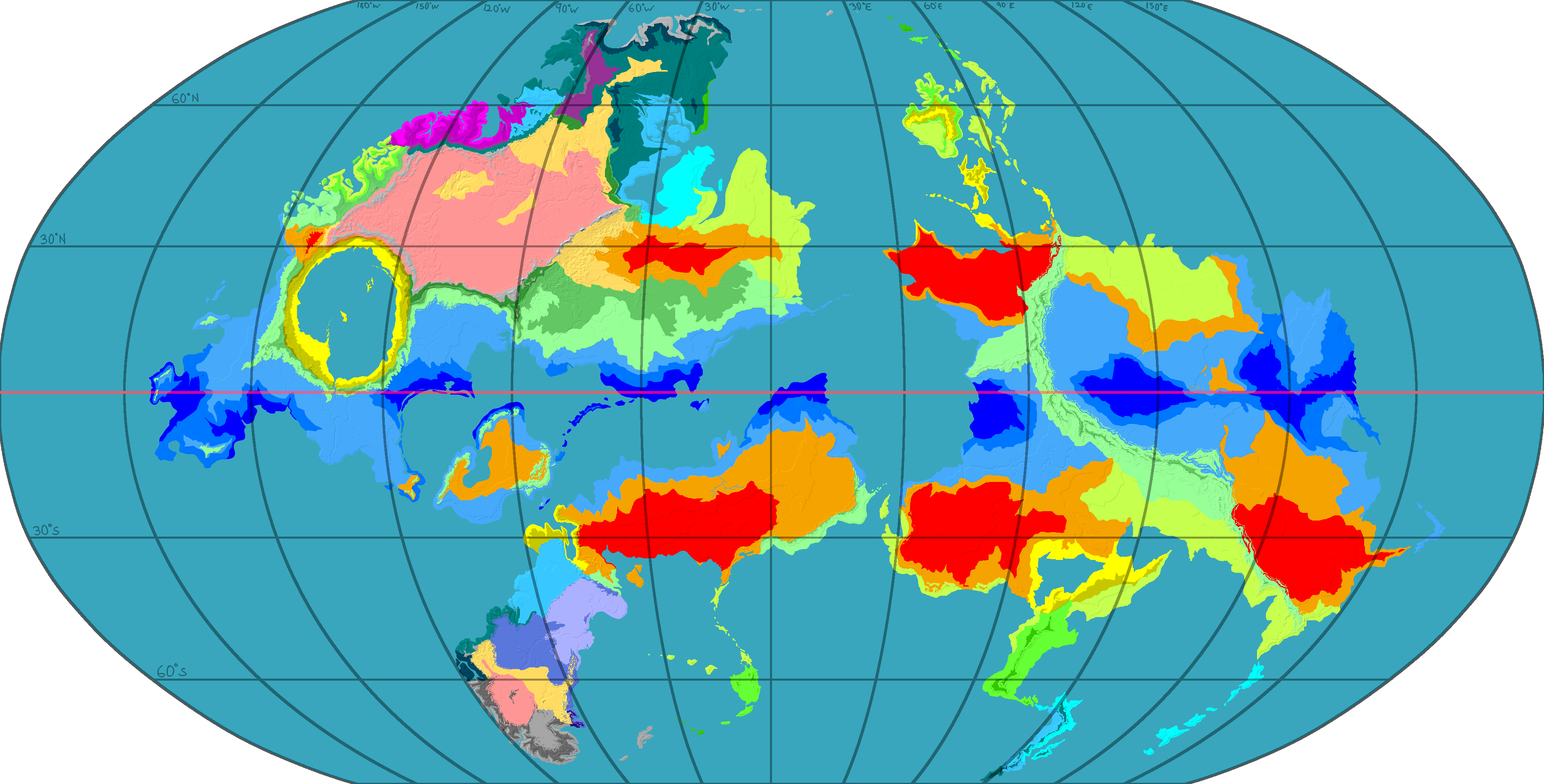
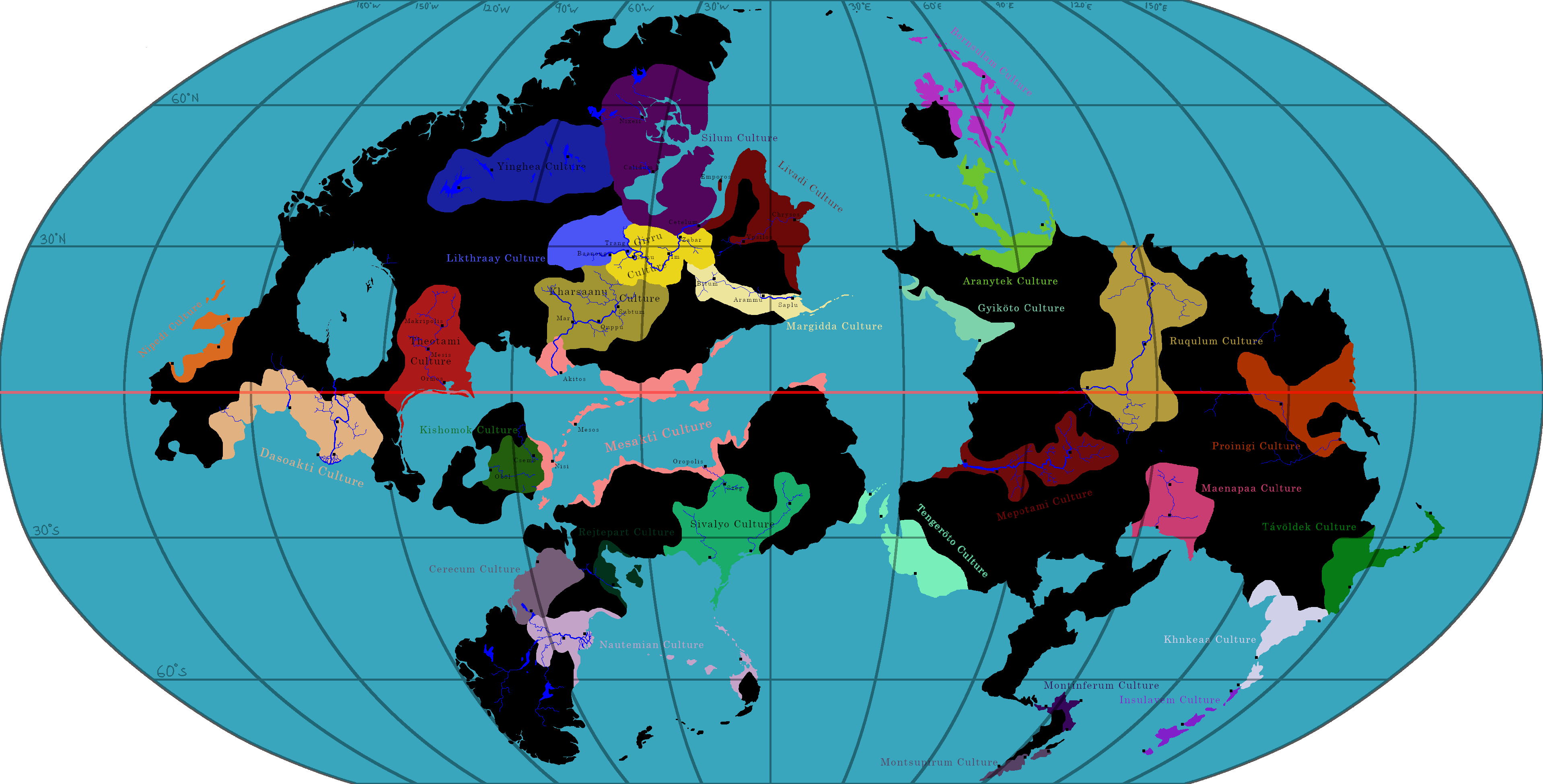
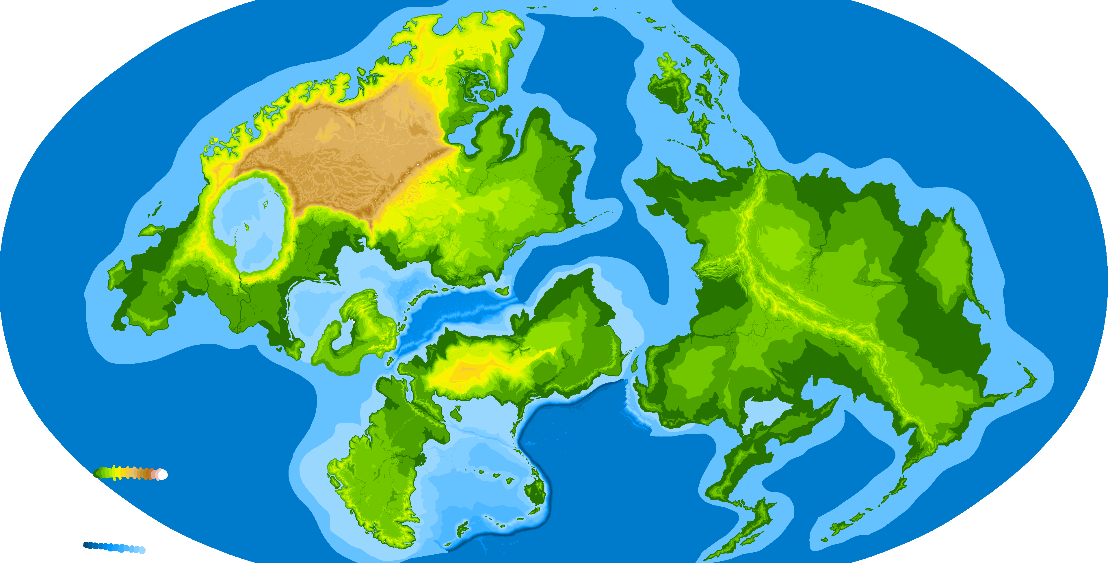
I'm giving this one a general heading because I intend to make more TES maps over time. I've done something strange with my depiction of Tamriel generally and High Rock specifically. If you peak at the locator map in the map below, you will notice I've rotated the entire continent a pretty big amount—this is on purpose! There's a prop in Daggerfall that shows Nirn as a globe and is the only canon depiction we have of the entire planet. On this image, you can just barely see graticules showing latitude and longitude, and it reveals that the whole continent was originally rotated as I've done here.
This is directly against the in-game map of Tamriel shown on the "race select" screen and the later folding maps distributed with other games. But! It matches Daggerfall's in-game navigation map's compass rose. Clearly, there was a change at some point in development. A mystery of the ages.
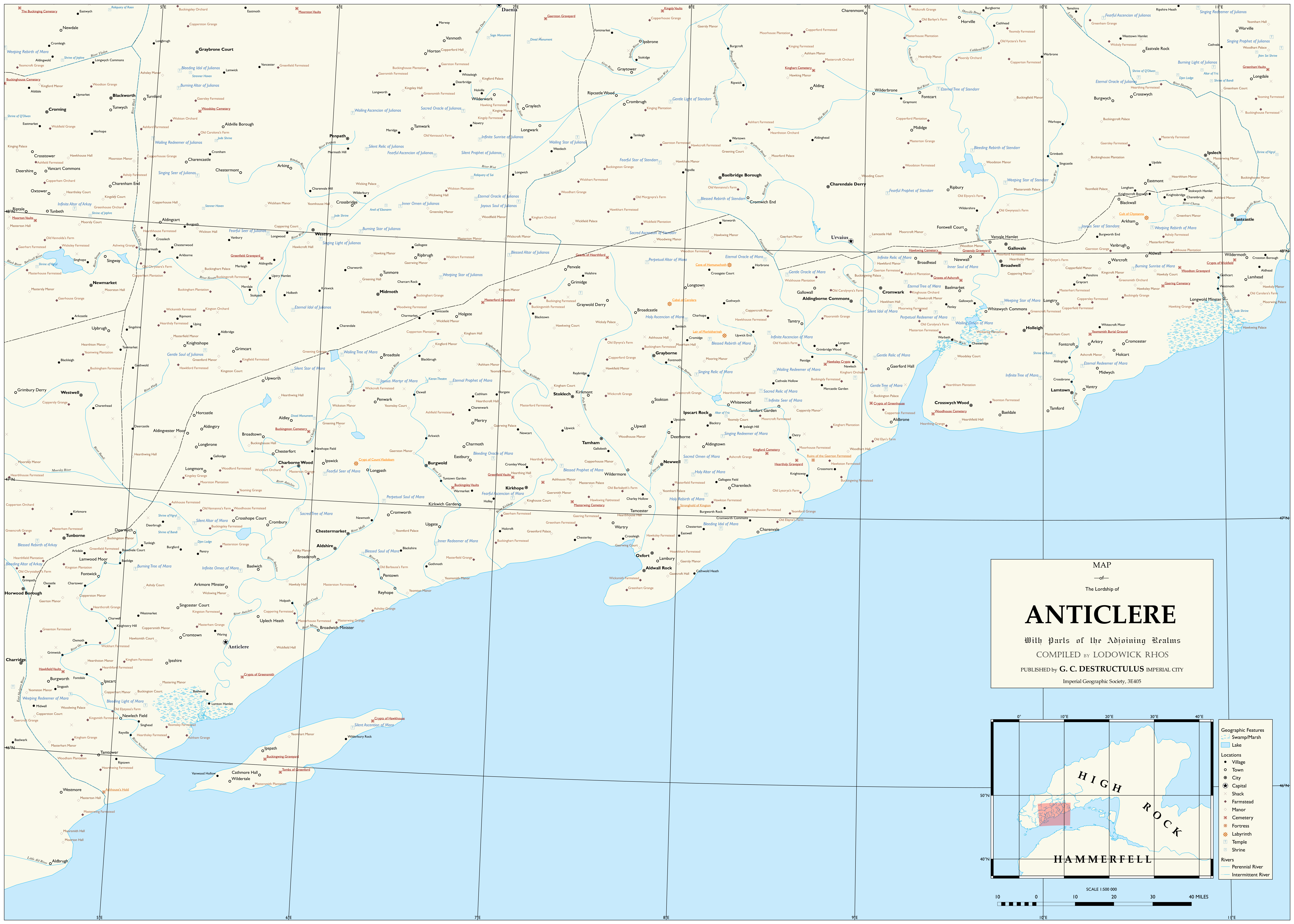
Anticlere
I picked Anticlere to do first because its the home of my player-character. "Says who?" Says the Anticlere-style shirt I found in Privateer's Hold. My Breton's got to be from somewhere, after all. Every point of interest revealed at game start is present on this map! That's approximately "too many" individual points. The lakes are all depicted in game, but I made up the rivers and fens myself because I have some kind of brain disease.
This map was made in QGIS!